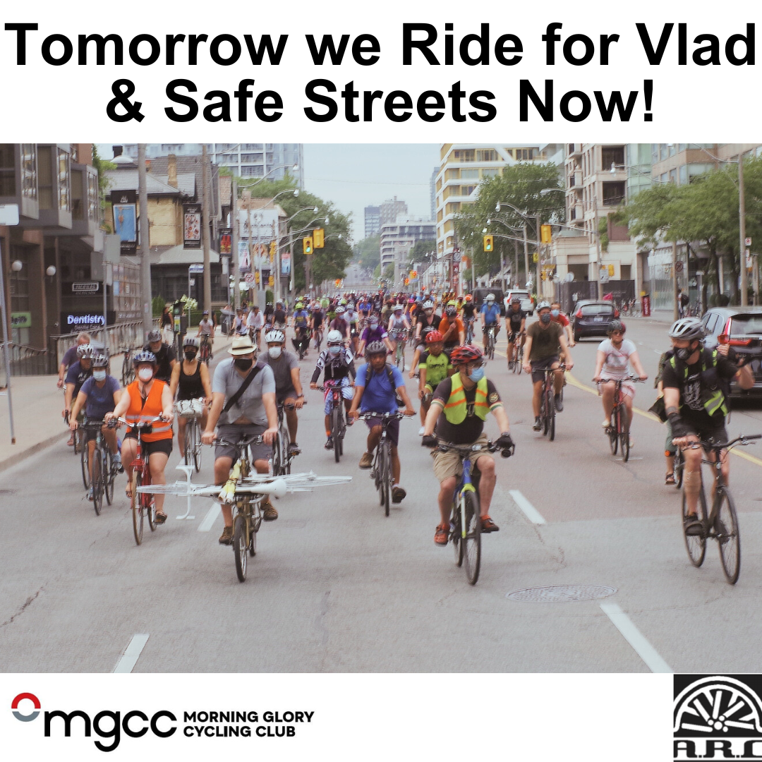
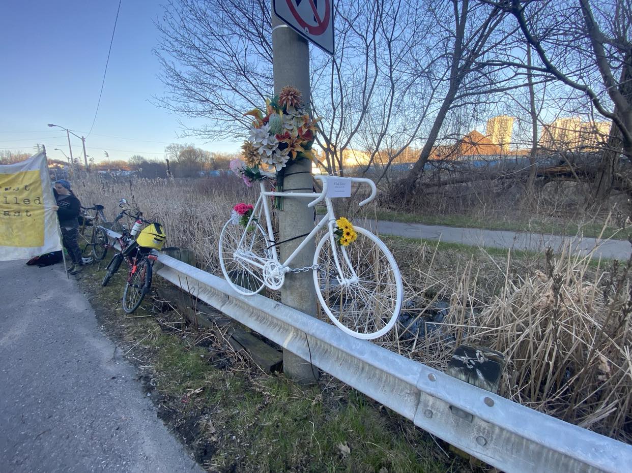
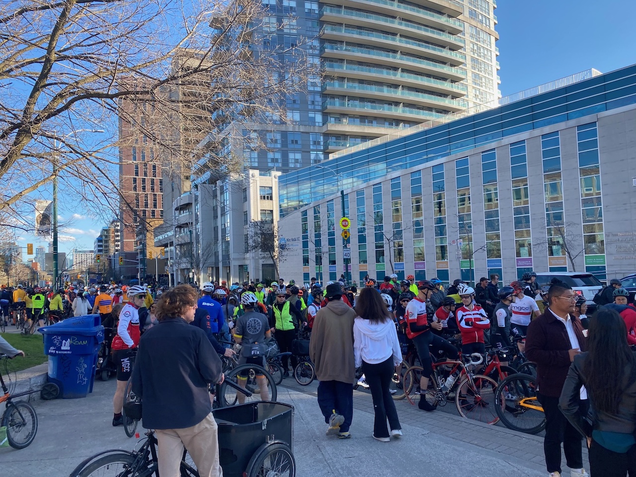
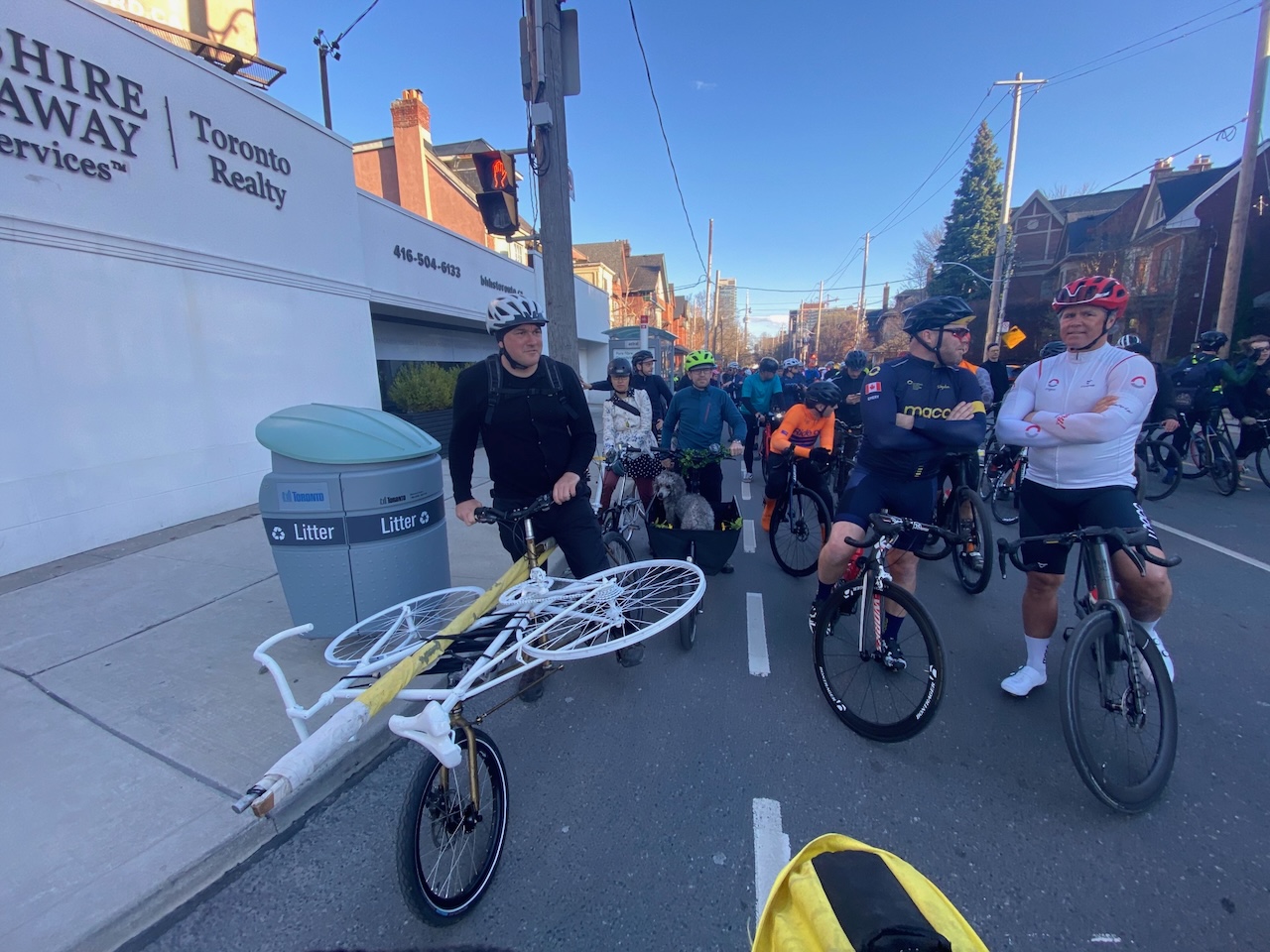
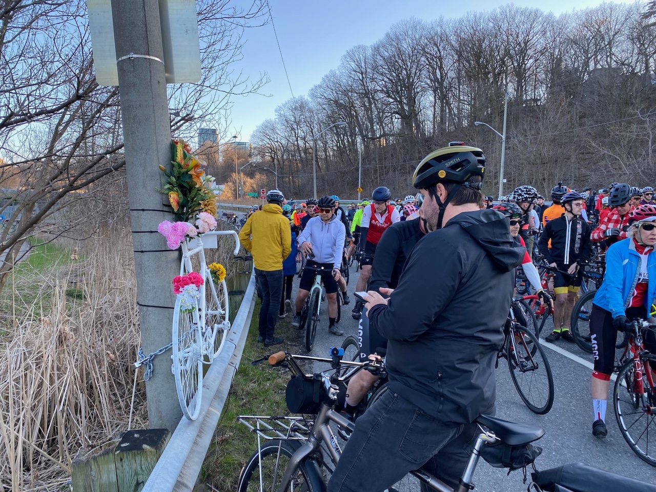
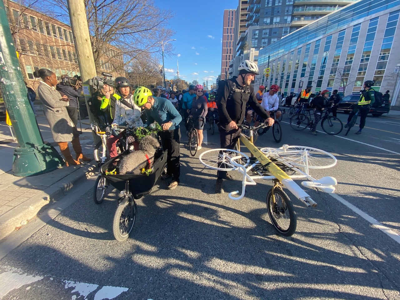
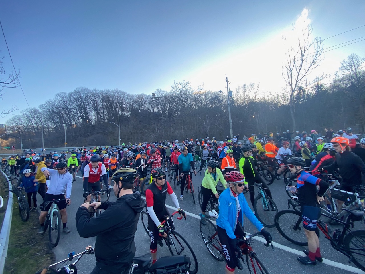
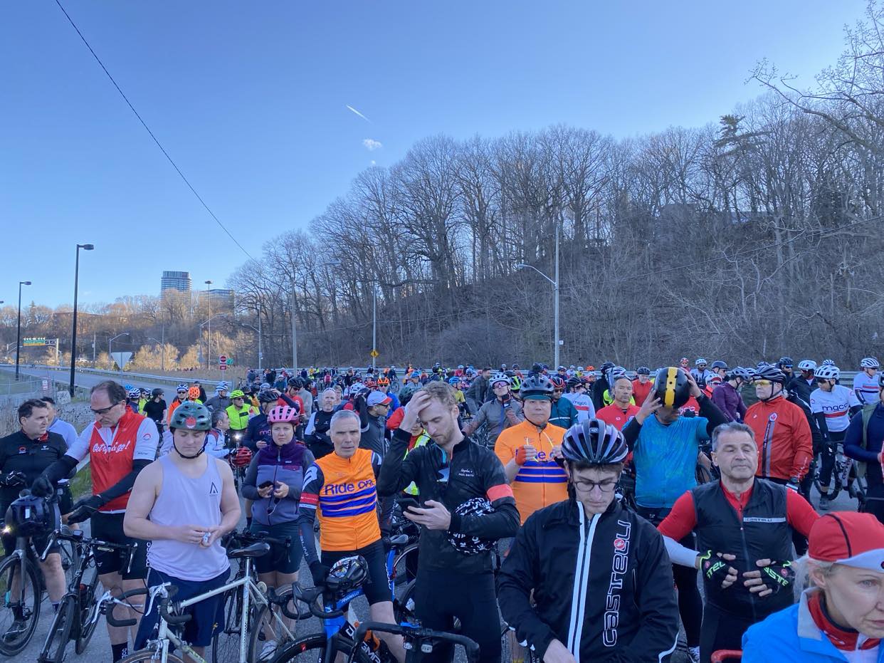
Vlad Zotov, a member of the Morning Glory Cycling Club, was killed on Monday, April 8 while he was riding on Bayview Ave. He was remembered as “a sensational human being“. Today was the ghost bike ride in his memory.
There was a huge turnout. Alas, I was not able to attend as I was out of country at the time. However, the pictures are rolling in, and Rob Zaichowski will be reporting on his blog.
Rob estimates that there were over 400 cyclists present. Here is a thread, starting with his video of the cyclists coming down Rosedale Valley Rd.
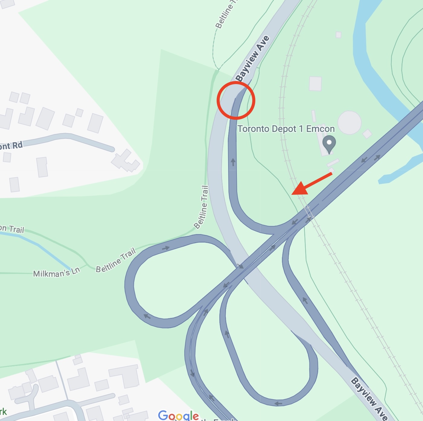
Although we will never know the exact circumstances, it appears that he was riding northbound on Bayview and was hit by a SUV exiting the DVP on the offramp marked by the circle. There is a northbound bike trail shown in green (red arrow) that parallels Bayview at this point, but my understanding is that it is in very poor condition so that it is not uncommon for faster cyclists to bypass it by riding on the road in this section. This has been confirmed by the report in the Star.
I hope that the city takes corrective action so that this will not happen again at this particular spot. Needless to say there are many such on and off ramps all across the city that are highly dangerous for cyclists.
Tonight, Councillor Morley hosted an online presentation on the Bloor St. extension through her ward. The tone of the meeting was set at the very start. Quite the difference with the previous community meeting held by Councillor Holyday.
Granted, given the webinar format, there was no opportunity for anyone to give unmoderated input. At the same time, there was a lot of information delivered by city staff from different departments. Unfortunately this left only about 10 minutes out of the hour for questions.
Just a few things that I noted in passing:
Phase 2 between Aberfoyle and Kipling will go forward starting in May as planned. At the same time, there will be adjustments made to what has already been installed during phase 1. The project website has a list of changes planned or made in response to feedback.
Among these changes will be an increase in the width of parking spaces along the Kingsway, facilitated by a slight reduction in the width of the bike lanes.
There will be an additional consultation in the fall focused specifically on the Bloor/South Kingsway/Mossom intersection.
There will be “special barriers” coming on the bike lanes on the bridge over the Humber.
Usage data collection post construction is underway.
The TransformTO goals for GHG reductions are very aggressive. For example, by 2030 they want 75% of all trips under 5 km to be by walking, biking, or transit. At the same time, although there was much talk about electrifying cars, there was no mention of subsidies to encourage e-bike usage.
In particular, the data from the projected development applications was really sobering.
Although I have no idea how the sums shown on the right side make any sense, the bottom line is about 16K new households, and more bike parking spaces than car spaces planned. It was also stated that there should be 1-2 bike share stations put in per 500 households.
One other item where I would like more information was offered in response to a question about traffic enforcement. It was noted that some of the transportation budget is used to fund police enforcement of issues related to vision zero. One would think that the police already had enough money to properly enforce traffic laws, and to improve traffic safety.
At any rate, thanks to Councillor Morley and city staff for their presentations. There will be another consultation in October, this time in person.
A cyclist was killed on Highway 7 just east of Acton on Sunday March 3, literally during the ghost bike installation that day in Scarborough. He was a 60 year old from Georgetown. No other details were available to ARC. Today we installed a ghost bike in his memory.
Here is the ghost bike, built up by Geoffrey as per usual.
This is the picture of the crash site as released by the OPP.
Joey with the ghost bike.
Chaining it up.
Decorating the bike.
photo: Joey Schwartz.
A moment of silence.
We will never know the exact circumstances of the crash, but the driver hit the cyclist on this wide shoulder.
Deepest condolences to the family and friends of the deceased.
Joey’s report and pictures are posted to Facebook.
Some puzzling signage at Yonge. Some of us took the lane, while others rode to the right of the bollards.
At Sherbourne. Thanks to Rob Z for the photo.
At Parliament.
Along Danforth. Thankful for the bike lane.
Making a staged turn at Dawes.
On Dawes Rd.
Working our way up the hill past Taylor Creek.
At St. Clair.
Many people gathered at the Warden Hilltop Community Centre.
Jonathan from Toronto East Cyclists told us how their group formed over ten years ago, galvanized by the removal of bike lanes on Birchmount and Pharmacy. They have been working since then to advocate for better cycling infrastructure in Scarborough, something that is sorely needed.
Marvin Macaraig from Scarborough Cycles reminded us the need for better infrastructure is a public health issue.
Ghost Ride on St Clair for a man killed in a collision while riding his bike on Monday. Some family members joined to grieve. Their anguish was gutting. Their gratitude that strangers would memorialize him was touching. Rest in peace, Billy. #ScarbTO#WalkTO#BikeTO#Clairleapic.twitter.com/utZCwa4T3Z
Ward 2 Councillor Stephen Holyday held a community consultation about bike lanes. The meeting was obstensibly about the proposals for the next phase of the cycling plan. However, the venue was selected to be the closest possible point in Ward 2 to the newly installed Bloor bike lane extension into the Kingsway, and it was clearly meant to be an opportunity for community members to vent about this installation.
The auditorium at Etobicoke Collegiate Institute was full. There was a podium at the front, and a table for Holyday and four city staff from transportation, including Becky Katz.
Holyday kicked off the meeting by noting that he voted against the extension of the Bloor bike lanes, and the big cheer and applause that followed set the tone for the rest of the evening.
He then showed the agenda which began with a 35 minute presentation by city staff, which drew howls of disapproval since many didn’t want to wait to complain about the bike lanes. It took a while for Holyday to setting things down, and he was clearly styling himself as the sage and sane voice in the room.
One of the first slides had a few points about the benefits of cycling, and this drew much derision, with someone yelling “show us the facts”. Clearly there was parts of the audience who regarded what was being presented as someones opinion, or someone else’s set of facts.
Again Holyday intervened and said that we should give staff the opportunity to give their presentation. He immediately undercut the presentation by noting that “The slides are controversial and you have to understand the context under which city council makes their decisions”. The clear implication that he thinks this is the Kool Aid that majority of council has drunk.
City staff didn’t help their cause with a slide listing the factors considered in building a cycling network, including equity, connectivity, potential cycling use, etc, with public consultation only shown as a subbullet under one of the eight factors listed. The context of the slide was that given the fact you are building a cycling network, what should be considered. The crowd was more interested in why the cycling network was being put forward in the first place.
There were a couple of new things that I learned about plans for Ward 2. First up was a list of potential bike lanes that were associated with future road reconstruction, i.e. an opportunity to put in permanent changes, with adjustments in road width, etc. Unfortunately, the timing for these projects will slide to at least three years in the future due to delays in the associated road or sewer work. This includes the potential extension of the Bloor lanes past Kipling.
The second set of projects did not involve road work, and so would be quick build if implemented.
The third set was a list of longer term projects being considered, requiring more study.
The final slide showed projects that were not being led by the city, including a potential greenway in a north south hydro corridor.
Again, Holyday provided a spin, “defending” city staff by saying that they are directed by council and they don’t have a choice in what they are doing. He repeated that on Bloor, there were only 0.3% of people travelling by bike.
At this point, it was time for questions. There were three mikes, and the one at the aisle were I was closest immediately at about 15 people lined up. Virtually all questions were about the Bloor bike lanes. There was one question about bikes on quiet streets decreasing safety for everyone. There were two complaints specifically about a proposed cycle track on Superior Ave in South Etobicoke.
Comments about fell into several general categories:
There wasn’t public engagement on these projects.
Given the lack of consultation, how can the audience accept the work of transportation staff?
Did staff consider congestion as a consideration?
What about emergency response?
Staff haven’t assessed the impact of what has already done. How do we take a step back? On this point, staff said that studies were underway, and the data will be studied starting in March. This drew much laughter as if a study could be conducted instantly.
The leader of one of the opposition group was given the opportunity to show a video (clearly this was prearranged) taken over a 24 hour period on Jan 14, with less than ten cyclists, and almost an equal number of bike lane snow plows. This drew much laughter.
One person polled 59 local business, and said that 57 were against.
At this point, it was clear that there was still much pent up hostility in the room. There were comments about Councillor Morley that do not bear repeating. On the point of what it would take to remove the bike lane, Holyday said that this would require 14 votes on council.
Time and again, Holyday held himself seemingly above the fray. He said that “I am a data and analyst person by nature” referring to the fact that one of his motions to ask for data about emergency response times was voted down. At another point, after a particular angry question, he said that he appreciated the vigour of the comment.
At this point, I couldn’t take the atmosphere of the meeting anymore. I felt bad that I didn’t stay until the bitter end to show my support to staff. I also regret that I didn’t stand up to speak, and I hope that Holyday is not able to say that not a single cyclist was support of the bike lanes during the meeting. There were two people who prefaced their comments against with the fact that they were “avid cyclists”.
As a postscript to the meeting, I walked out with a nicely dressed woman who said that Mayor Chow is driven to within a few blocks of City Hall every day, and then hops on her bike. She also said, and I quote: “If I saw Comrade Chow on her bike, I would steer into her.”
I was cheered a bit by seeing some familiar machines parked outside.
It is important to understand the depth of feeling among the opposition to bike lanes, and not just to dismiss their arguments as being without merit.
However, to paraphrase a quote form HG Wells: after a meeting like this, I despair for the future of the human race.
On a side note, there was quite a hefty wind out of the west along with a significant drop in temperature by the evening.
Someone posted this image:
This was our wind gauge in the front yard as I set off.
I’ll note that my ride west from Runnymede took me over 19 minutes, and the ride back took under 13. In both directions, I appreciated the Bloor bike lane extension.
This week, a Council colleague held a consultation on the Cycling Network Plan in Ward 2, Etobicoke Centre. Much of the discussion focused on the Bloor West Complete Street project, a project in Ward 3, Etobicoke-Lakeshore.
Mike talked about the importance of recognizing the toll that unsafe infrastructure takes on pedestrians and cyclists.
Someone needs to get him a better pair of mittens 😉
We wrap things up in preparation for the ride back.
Deepest condolences to the family and friends of the deceased.
Thanks to everyone who rode with us on a bitterly cold day. Thanks also to Janice for organizing, to MP Morrice for riding with us, and to Red Racoon Bike Rescue for furnishing the ghost bike.
The Community Bikeways Coalition has been holding Friday morning meetups for coffee along the Kingsway to show local merchants that customers can and do bike to their stores, even in the dead of winter. Today’s site was actually in Bloor West Village, at the Coffee Tree just east of Jane.
I wasn’t sure if the cafe allowed dogs, so everyone was good enough to join Loki and I outside for a photo.
photo: Emily
If you want to join us on an early Friday morning, the location of each meetup is announced on the TCBC Facebook page.
Since yesterday was the first significant snowfall for a while, I’ll add a few notes on snow clearance.
Headed down to Bloor on Runnymede, the bike lane plowing was OK in spots but a bit inconsistent as you can see in these two photos.
The Bloor bike lanes in BWV were well plowed, although there were a few minor windrows.
On his way over, Albert had a conversation with a contractor who was dumping snow into the bike lanes, but then agreed to be more careful to keep them clear.
Here is a mini plow making a salting run.
Side streets can be slippery. Ride safe out there!
The start point of the ride was Kennedy Station. The ghost bike arrives.
A group picture at the start. I count 26 in the picture.
Joey outlines the route, which is mainly along Midland Rd.
Off we go.
We start on the hydro corridor leading north from Kennedy Station.
Cycling up to the Moorgate Bridge over the former line 3.
Impressed that Geoffrey could navigate the switchbacks, as well as Chris on the USS recumbent.
It took a while for the whole crew to clear the bridge. You can see a very patient dog owner waiting for us to the left.
Pausing on Romulus just before turning north on Midland.
Riding north on Midland.
Now about the turn onto the Finch Hydro corridor. Note that the white line is not considered a bike lane as it is quite narrow.
That’s Brimley up ahead.
The ghost bike arrives.
You can see other riders crossing at McNicol where the crash occurred. There were about eight people that were waiting at the crash site.
Setting up the ghost bike.
A minute of silence in memory of the deceased.
North Scarborough Councillor Jamaal Myers has been in contact with the victim’s son. He reiterated the city’s commitment to vision zero. He mentions that too many of the city’s pedestrian and cyclist deaths happen in Scarborough.
The banner.
Decorating the bike.
I chose to ride back south with these speedy folks. Good to see Michael Longfield back in the saddle.
We rode down Brimley and then turned west on Huntingwood Drive to check out the bike lanes. A section further to the west (between Pharmacy and Kennedy) are due to be reconfigured and improved soon.
Southbound on Midland there is a marked bus/bike lane that was apparently added when Line 3 was closed.
Thanks to everyone who rode with us. I hope that everyone made it home safe.
Deepest condolences to family and friends of the deceased.
A few notes on logistics. Note that the banner is quite unwieldy to transport by bike on the subway. We are working on a replacement with collapsible poles.
Also, these are the things that I bring to a ghost bike installation.
Flowers. Plastic ones last longer.
White zip ties.
Scissors.
A sign. In some cases like today, I bring a spare blank in case we learn the victim’s name at the crash site.
Sharpies for people to write on the ghost bike.
Of course, Geoffrey does the heavy lifting of making the ghost bike, and David brings the chain and lock.
Update: Brian’s video of the ride, including the comments by Councillor Myers at the crash site.
Today was the annual Coldest day of the year ride organized by Cycle Toronto. Today’s route started at Tom Riley Park in Etobicoke to draw further attention to the westward extension of the Bloor bike lanes that was implemented last year. The weather was even warmer than last year, and so the turnout was significant. According to Brian Tao, there were almost 200 riders (including passengers on cargo bikes).
Cycle Toronto executive director Michael Longfield and Councillor Amber Morley make a few announcements and generally rev the crowd up. Councillor Morley has been steadfast in her support for these bike lanes.
Off we go.
Many familiar faces.
Albert remarks on the large turnout.
Headed down towards Old Mill.
Now back up the hill past the Humber River.
Some fast guys at Bloor and South Kingsway wish us a good ride.
Now at Bloor and Windermere.
Heather and her wool Cleverhood.
We turn into High Park for a regroup.
Now past Keele, headed up towards Indian Rd.
Cyclists as far as the eye can see.
Nice to see the underpasses not blocked by construction, but we still need protection.
That Bloor bike lane is full.
Michael helping to cork at Shaw. Good to see him back on a bike, albeit one that probably weighs three times his usual.
The ride ended at Christie Pits. My phone has been acting up, so I don’t seem to have any of my pictures there.
Nice to see so many people out on this sunny warm February day. Thanks to Cycle Toronto for organizing. Also thanks so much to the riders who picked up the pannier that I dropped while riding through the Kingsway. That pannier had one of my cameras, and if they hadn’t rescued it, there would be many fewer pictures on this blog post.
We’ve had very little snow this winter, and so this is the first snow clearance report for this season, and it’s already January. In the High Park area, we got between 3-5 cm overnight. There were two earlier bits of snow, but they resulted in more salt than snow on the roads.
Side streets have not been plowed, but are passable.
Busier streets like Runnymede have been plowed; however, the on street bike lane has not yet been plowed. I am riding in the traffic lane which is clear, but some might not be comfortable with this. Also if there had been more snow, the bike lane would be impassable.
You can see that Annette St also has the same issues. I have noted inadequate snow clearance for the Annette St bike lanes manytimes in the past.
The Bloor bike lane through Bloor West has been nicely cleared.
Nice to see that this particular plowing has not affected the ramps on the zicla platforms.
The city’s snow clearance of the cycle tracks has really improved over the past few years. However, clearance of the on street (painted) bike lanes has remained as an issue. Councillor Diane Saxe has submitted a letter that asks that the city do a better job of winter maintenance on the on street bike lanes. It will be considered by IEC this coming week, on Jan 9, and then potentially by City Council in February.
You can go this page in order to submit comments on this item.
The summary of recommendations.
Councillor Dianne Saxe recommends that:
1. City Council direct the General Manager, Transportation Services to take all reasonable steps to make designated bike lanes safe and passable for bicycles during the winter season.
Summary
The minimum standard of ice / snow management on most Toronto streets is described as “safe and passable”. In practice, Toronto streets are almost always “safe and passable” for cars and trucks. However, bike lanes are only “safe and passable” when they are “safe and passable” for bicycles. In Toronto’s weather, because of our frequent fluctuations above and below zero, no bike lane is “safe and passable” unless it is cleared to bare pavement. Layers of snow / slush that are passable for cars quickly become icy and unsafe for bicycles.
Last year, protected bike lanes (cycle tracks) were generally properly cleared after the first few weeks of confusion. However, on-road bike lanes were often left hazardous with frequent patches and barriers of ice, especially in the most dangerous locations such as curves and hills.
Improved winter bike lane maintenance is necessary for Vision Zero and to support Toronto’s climate commitments, in particular to allow three quarters of local trips (year round) to be made by foot, bicycle or transit by the end of this decade. It is also necessary to support other city initiatives, such as the five dollar a year Bikeshare membership just extended to Toronto Community Housing Corporation tenants, and the work being done to encourage downtown deliveries by cargo bike.
It’s important to remind the city that cyclists do depend on cycling infrastructure during the winter.
BTW: here is the city’s page on winter cycling, including notes on infrastructure winter maintenance.